The Southern Way 1000 is Aotearoa New Zealand’s latest fully mapped and published bikepacking route. The journey of up to 1,000km connects a network of cycle trails that encompass the most dramatic and varied landscapes of Te Wai Pounamu, the South Island.
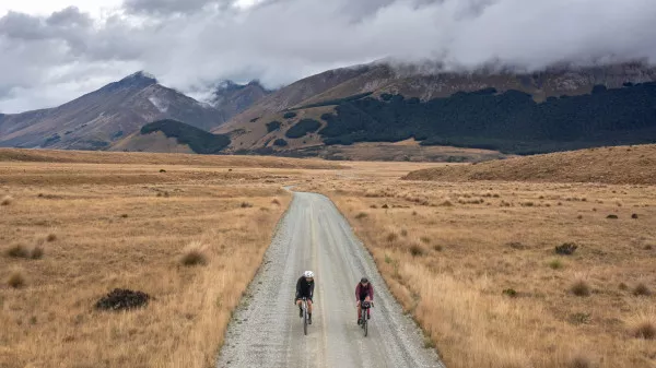
The multi-day cycling route is comprised of a figure-eight loop around the lower South Island and stretches from the Southern Alps in Queenstown to the coastal landscapes of Dunedin, and back. The scenery is constantly changing as you ride from glacier-carved lakes and mountains to deep river gorges and rugged, tussock-clad high country; from vineyards to lush rolling farmland; and from meandering rivers to coastal plains and the South Pacific Ocean.
The route can be ridden in its entirety over 1-2 weeks but can easily be split into shorter sections or itineraries, with each of the cycle trails offering unique, standalone experiences. Planning is made easy with local cycle tour companies offering a variety of itineraries which include bike hire, accommodation and transport packages.
The Classic Southern Way 1000 Route
Ride from the mountains to the sea and back again
Distance up to 1,000km | Vertical Ascent 10,000m | Grade 2-4
Duration 1-2 Weeks | Surface 80% Gravel : 20% Paved
The Southern Way 1000 can be ridden in a clockwise or anticlockwise direction, and you can choose anywhere along the route to start and finish. However, with international airports providing ease of access, Queenstown or Dunedin are practical starting points. Invercargill Airport is also an option with the Southland Traverse ‘Heartland Ride’ connecting to the Around the Mountains Cycle Trail.
More than 600km of this multi-day bikepacking route follows the network of Ngā Haerenga Great Rides of New Zealand - purpose-built, gravel cycle trails - with quiet backcountry gravel roads connecting these bike trails to minimise the amount of riding on paved roads. Less than 20% of the route is on paved surfaces.
The Classic Route is 910km, but with must-do, scenic side trips adds up to make an epic 1,000km journey through the icons of the South Island. The route is broken down into seven stages, and each graded in terms of difficulty, with Grade 1 being easy and suitable for most ages and abilities and Grade 4 being difficult and requiring experience and good fitness.
If you've completed the Southern Way 1000, then please record your ride in the online visitors book!
Southern Way 1000: Stages
Stage 1: Queenstown to Garston
163km via Around the Mountains Cycle Trail
Distance 163km | Ascent 1,142m | Grade 2-3 | Duration 1-2 Days | Surface 95% Gravel 5% Paved
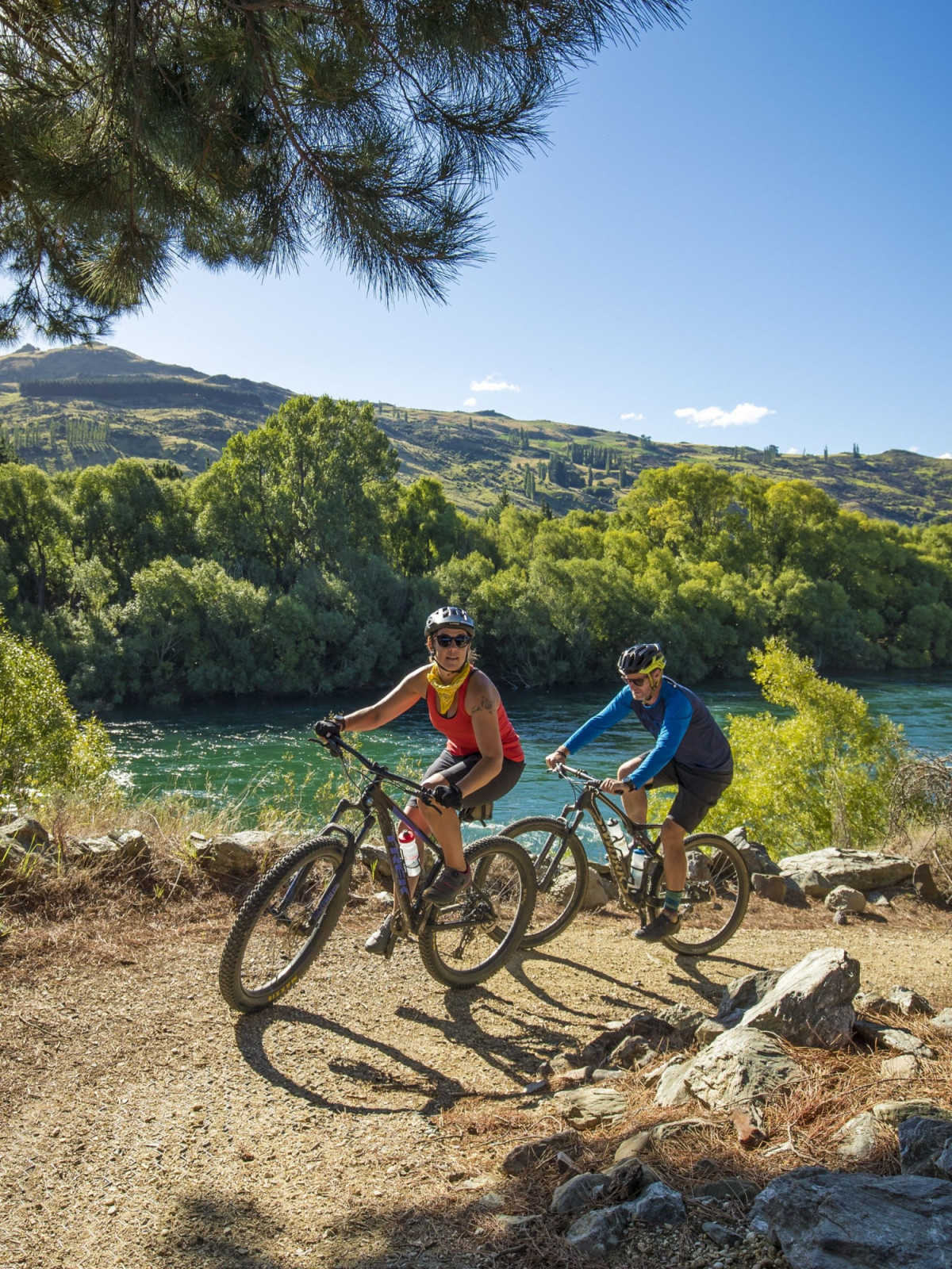
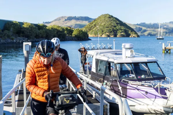
Queenstown is a mecca for biking and so a fitting place to start this adventure. The airport is well serviced with regular domestic flights and daily connections to Australia. Queenstown offers a huge variety of accommodation to suit different travel styles and budgets with a myriad of cafes, bars and restaurants for pre-ride fuelling or post-ride celebrations upon completion of the Southern Way 1000. You’ll also find numerous bike shops for spares and help with any last-minute mechanicals.
This epic cycle journey starts with a crossing of Lake Whakatipu from central Queenstown to Walter Peak High Country Farm and the beginning of the Around the Mountains Cycle Trail. RealNZ offer regular cruises across the lake, with other private charter services also available.
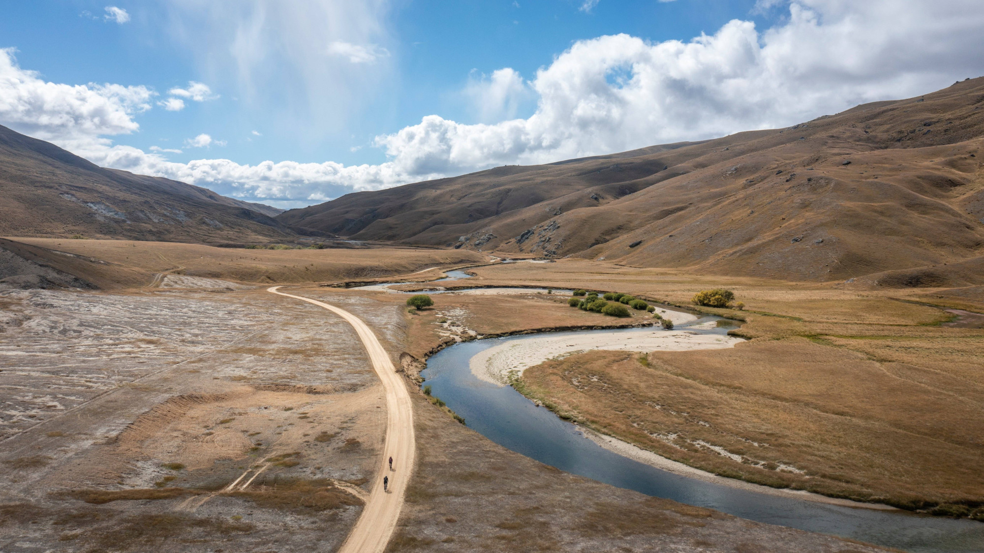
Departing Walter Peak, you’ll follow the Around the Mountains route steadily uphill through the stunning Vonn Valley. Whilst the gravel road is quiet, be aware that it is open to traffic. From the summit of Vonn Hill descend to Mavora (50km) where a short detour through the rainforest to Mavora Lakes is worthwhile. Camping is available here.
From Mavora it’s a mostly flat or downhill 53km ride to Mossburn where a selection of cafes and accommodation are available. For many people, this is likely to be a good place to finish day 1 of the ride. From Mossburn it’s a further 60km to Garston, with accommodation and food options also available at Lumsden, Five Rivers and Athol.
From Garston, the Around the Mountains Trail continues to finish in Kingston, but the Southern Way 1000 route heads eastwards here and up into the Hector Mountains.
A great accommodation option in Garston is at the Welcome Rock Trails which offer authentic farm stay style cottages at the base of the Nevis Road, or rustic backcountry huts at the top of the Nevis Road. These huts are part of a 27km single track MTB loop trail – a worthy addition to the ride for those on mountain bikes.
GPX coordinates and map
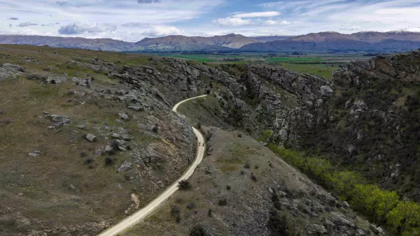
Stage 2: Garston to Alexandra
105km via Nevis Road & Hawksburn Road

Distance 105km | Ascent 2,278m | Grade 4 | Duration 1-2 Days | Surface 97% Gravel : 3% Paved
If this was Le Tour de France, stage 2 would probably be the Queen Stage….
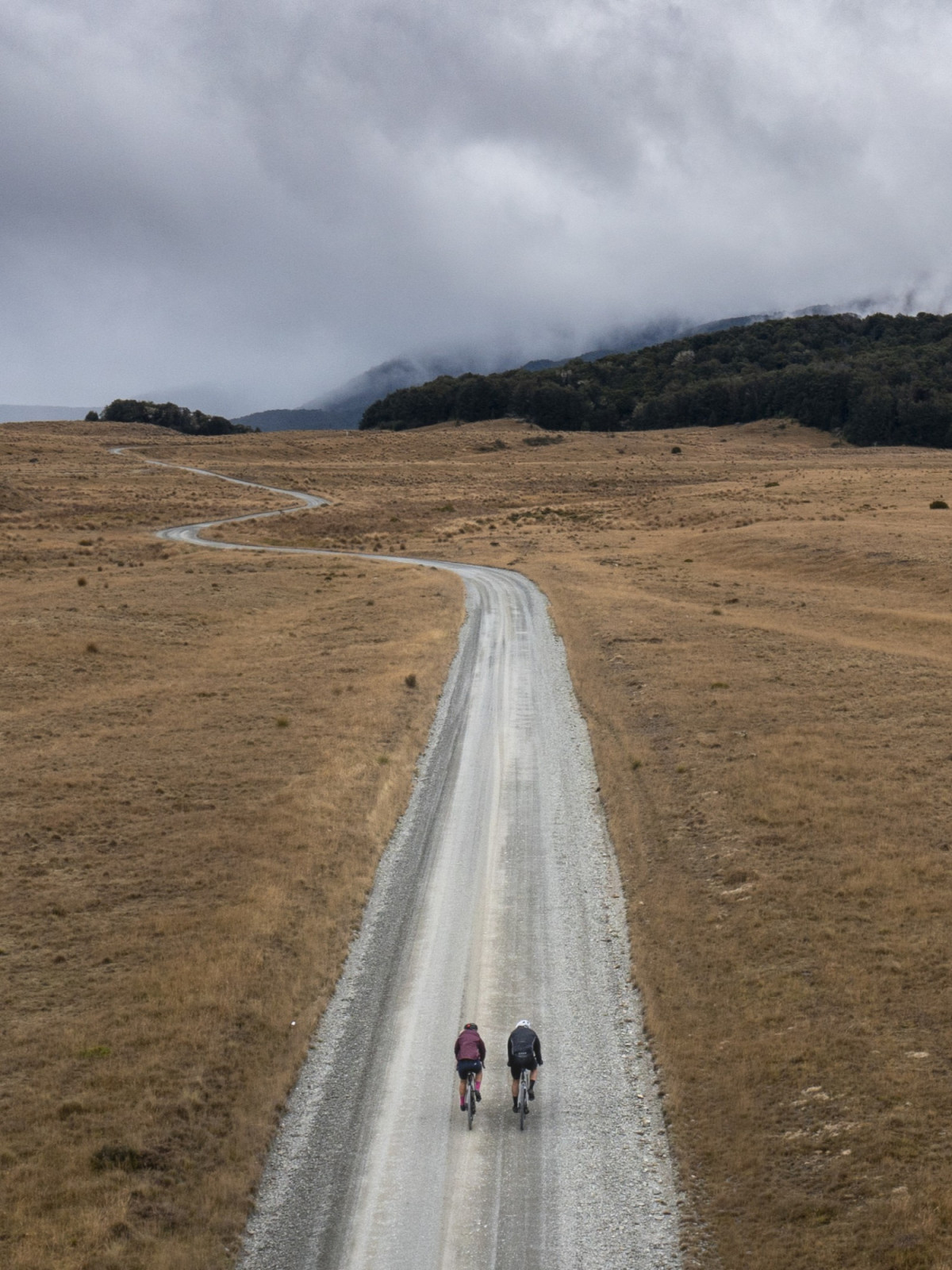
The Nevis Road is one of NZ’s most remote and scenic public roads. It is a challenging day out by any cyclist’s standards and traverses a wild, backcountry environment with over 2,000m of climbing. For well-prepared riders, and with the right weather, its often one of the highlights of the Southern Way 1000.
From Garston it’s a 10km climb (800m ascent) up the Nevis Road to the historic Garston Ski Hut, a good place to catch your breath and take in the spectacular views. This old hut provides good shelter from the elements in poor weather but is very basic for overnighting.
Departing the ski hut descend into the Nevis Valley (take care on the descent as the road can be lose and rutted). From here the route undulates alongside the Nevis River with numerous creek and river crossings. After 52km, cross the Nevis River via a small bridge and begin the 8km climb up Duffers Saddle which tops out at 1,270m above sea level.
(Top Tip: riding the Southern Way 1000 in an anticlockwise direction avoids a steep climb up Duffers Saddle from the Bannockburn side, and a very steep ascent up the Hawksburn Road from Clyde).
The steep and sometimes rutted descent from Duffer’s Saddle leads to a T-junction in the valley where the route turns right onto Hawksburn Road, and a hilly 20km ride across the Cairnmuir Mountains to Clyde.
An alternative option at the end of the Nevis Road is to turn left and deviate a short distance to either Bannockburn or Cromwell, where there’s a variety of accommodation, shops (including bike shops) and cafes. Likewise, at the end of the Hawksburn Road, there are excellent accommodation options, cafes and services in Clyde.
From Clyde the route continues along the true right of the Mata Au | Clutha River on the River Track to Alexandra, where there are supermarkets, bike shops, cafes, restaurants and numerous accommodation options.
After a huge day in the saddle, you may feel like indulging yourself with a spot of luxury. If so, Earnscleugh Castle is the place for you. Located between Clyde and Alexandra, this lovingly restored heritage building offers a unique stay where the spa, sauna and pool are perfect for revitalising weary muscles.
Important Notes:
- This is an isolated, backcountry route and riders need to be self-sufficient with appropriate clothing, food, water and tools.
- The Nevis Road is closed over winter (June – September) due to snow and ice.
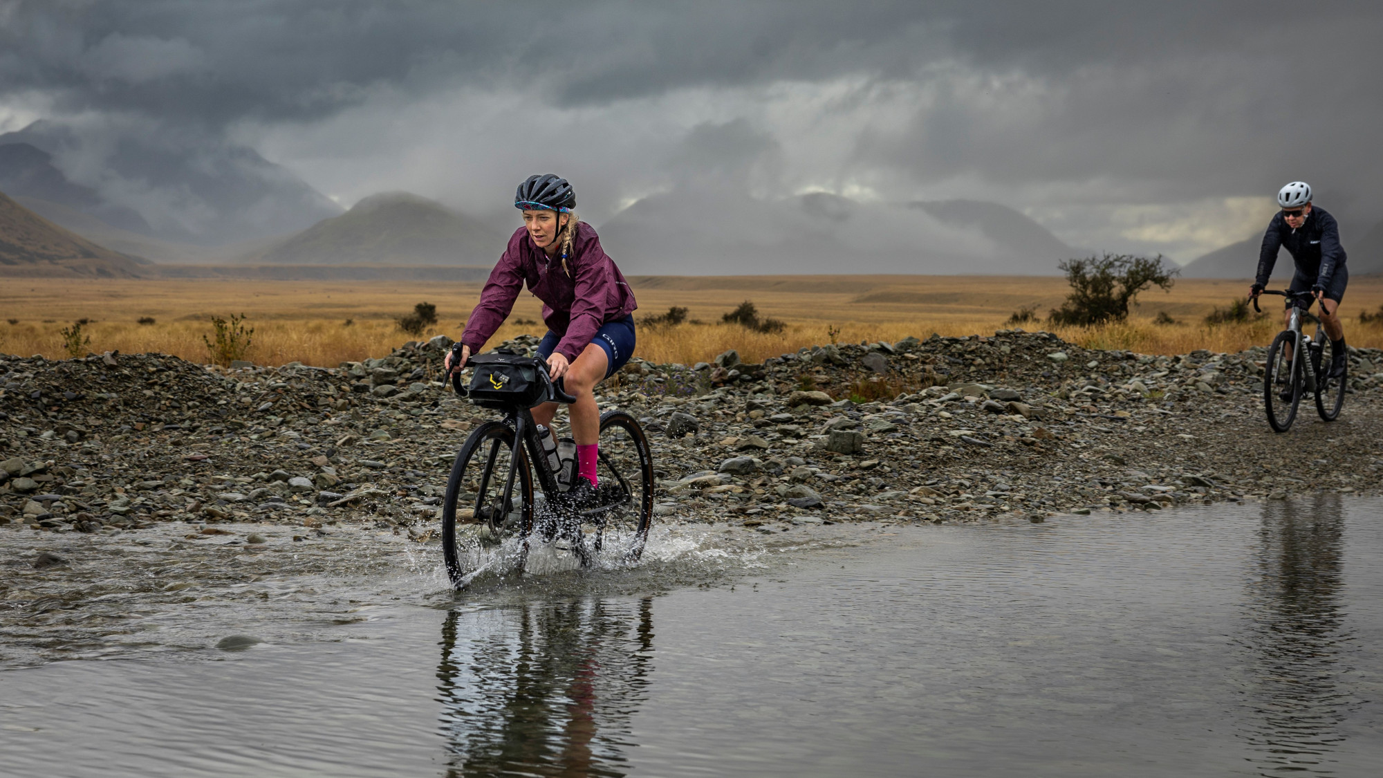
- There are numerous river crossings on the Nevis Road. Do not attempt this route after heavy rain.
- The Nevis Road crosses a sub-alpine area and can be subject to extreme weather at any time of year.
- The road is open to traffic: look out for farm vehicles, recreational 4WDs and motorbikes.
Stage 3: Alexandra to Dunedin
214km via Roxburgh Gorge Trail and Clutha Gold Trail
Distance 214km | Ascent 1,788m | Grade 2-3 | Duration 2-3 Days | Surface 75% Gravel : 25% Paved
The Roxburgh Gorge Trail starts under the Alexandra Bridge and follows the true right of the Clutha River deep into the Roxburgh Gorge to Doctors Point (10km). At this point a jet boat (water taxi) transfer is required to connect with the other end of the trail 12km downstream at Shingle Creek (bookings essential). The 12km ‘gap’ in the trail is currently under construction and due to open in early 2027.
From Shingle Creek the trail undulates up and down through the dramatic, rugged landscape of the gorge – which has become known as New Zealand’s Grand Canyon. The trail includes some short grade 3 sections which are narrow and exposed with short, sharp climbs or descents.
10km downstream from Shingle Creek, the trail makes its way up a series of switchbacks to a lookout over the impressive Roxburgh Dam. Cross the dam to connect to the Clutha Gold Trail on the true left of the river and then follow the trail to Roxburgh which has a good selection of cafes and a small supermarket. It’s also home to Jimmy’s Pies - world famous in NZ!
The Roxburgh Gorge Trail is a popular day ride, with bike hire and shuttle packages available from local bike tour companies.
From Roxburgh the Clutha Gold Trail meanders alongside the river as far as Beaumont (44km) and then on to Lawrence (20km) which makes a convenient overnight stop. From Lawrence its 63km to Waihola on a newer section of trail which opened in August 2023. Fish and chips on the lakefront in Waihola is an absolute must-do! Accommodation options are also available in Waihola.
The route from Waihola to Dunedin (44km) follows the spectacular coast road (paved) northwards from Taieri Mouth. Dunedin is the principal city in the Otago region; with all the services you’d expect from a metropolitan area… including bike shops and a significant number of craft breweries! Stage 3 of the Southern Way 1000 finishes on the Esplanade, St Clair in a picturesque beachfront setting, but excellent accommodation options are available city-wide.
An alternate route from Waihola to Dunedin - longer and with more climbing but 60% gravel - follows Taieri Beach Road to Taieri Mouth, then Otokia - Kuri Bush Road and Big Stone Road to Brighton. From Brighton hug the coast to St Clair or head inland to central Dunedin via Scroggs Hill and Saddle Hill. See the route here.
GPX coordinates and map
Stage 4: Dunedin to Middlemarch
125km via Otago Harbour Cycleway, Coast Road and Ramrock Road
Distance 125km | Ascent 2,437m | Grade 3-4 | Duration 1-2 Days | Surface 54% Gravel : 46% Paved
Another contender for the Queen Stage, with a serious amount of climbing on a backcountry road which will take your breath away (literally and figuratively)!
There are numerous ways to navigate your way through Dunedin to Port Chalmers where the route follows Blueskin Road and then Coast Road north via the picturesque seaside town of Karitāne to Waikouaiti, but the Otago Harbour Cycleway (Te Aka Otākou - The Otago Vine), is a great way to experience the harbour city.
If you stayed in St Clair, follow the beachfront to Portobello Road and then join the cycle path which hugs the southern side of the harbour. At Portobello hop on to the Port-to-Port Ferry (bookings required) for a scenic cruise across the harbour to Port Chalmers.
An exciting new cycle trail is currently under development to connect Port Chalmers with Waikouaiti. Currently only 5km of the Coastal Connection is open and this short section has been included in the map and GPX coordinates for stage 4.
Grab a coffee in Port Chalmers before climbing up Blueskin Road and then Coast Road to Waikouaiti. This part of the route includes two short sections on a busy state highway (SH1) so take extreme care. Make sure you resupply, fill water bottles and refuel in Karitāne, Waitati or Waikouaiti as there are no services on the next 65km section of the route to Middlemarch on Ramrock Road.
Shortly before Waikouaiti, turn left off SH1 and head inland on Ramrock Road, and some of the best gravel riding you’re likely to experience in New Zealand. The road climbs quickly from the coast, offering expansive views, and then rolls up and down valleys (sometimes steeply) all the way to Middlemarch. (Note: Ramrock Road is remote and is not recommended in winter, when it can be subject to snow. Expect to encounter farm vehicles, 4WDs and livestock).
The Strath Taieri Hotel in Middlemarch offers basic but very comfortable accommodation. Hearty pub grub and a cold beer is reward following a long day in the saddle.
Top Tip: If you want to avoid 2,000m of climbing, then catch the train! Dunedin Railway Station offer a service from Dunedin to Pukurangi (a 20km gravel ride south of Middlemarch) which includes the spectacular Taieri Gorge, one of NZ’s great train journeys.
GPX coordinates and map
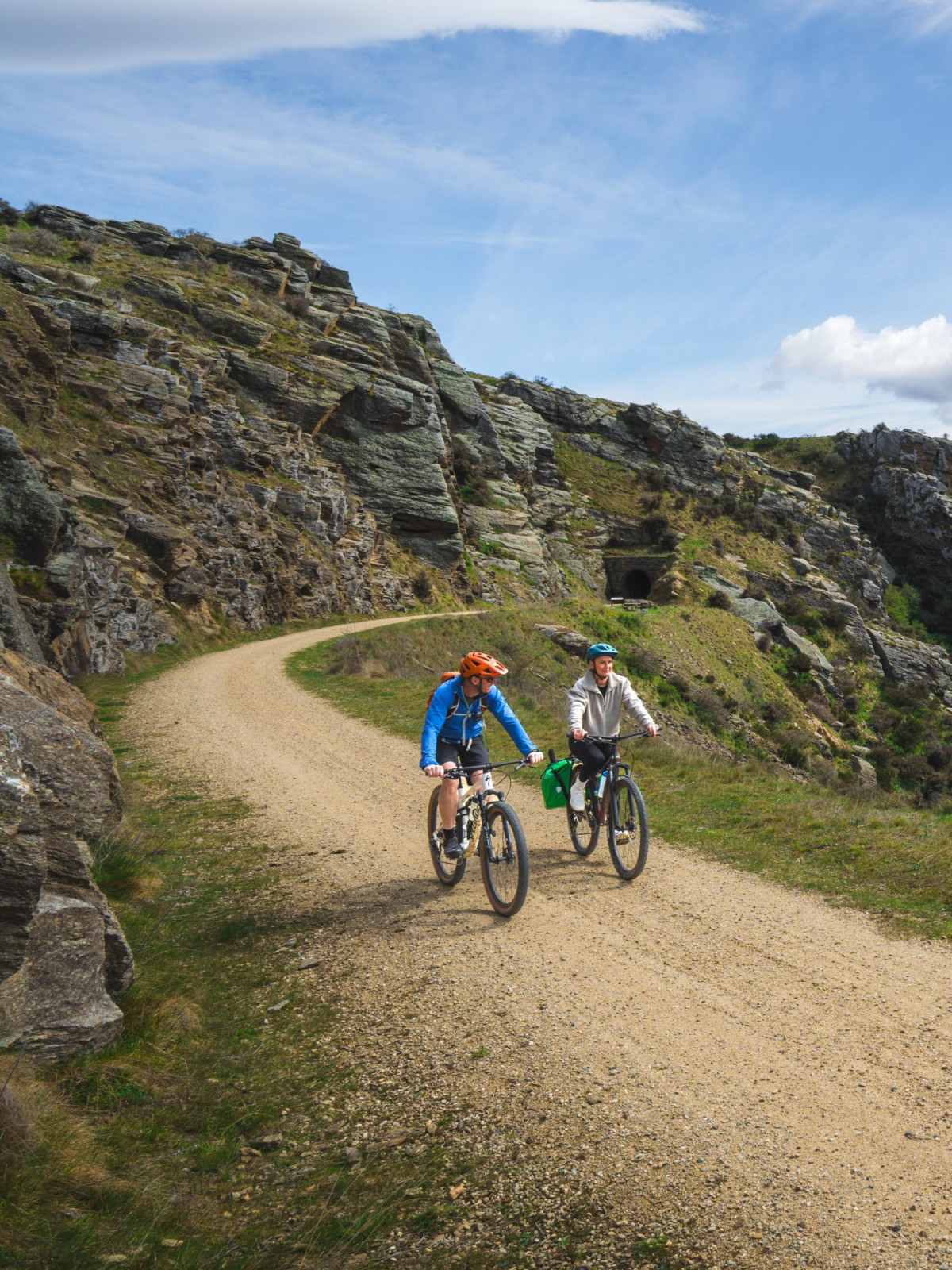
Stage 5: Middlemarch to Clyde
152km on the Otago Central Rail Trail
Distance 152km | Ascent 1,038m | Grade 1 | 2-3 Days | Surface 100% Gravel
If one trail can lay claim to starting New Zealand’s modern-day love affair with cycling, it’s the classic Otago Central Rail Trail.
Opened in 2000, it was the country’s very first Great Ride and was borne out of tough times. Back in the 1990s, the rural communities of Central Otago were struggling. A downturn in farming meant small towns were losing shops, garages, post offices and even schools.
When the old railway line between Middlemarch and Clyde was officially decommissioned, a group of locals together with the Department of Conservation led a visionary project to transform the disused 152km rail corridor into a dedicated trail for cycling, walking, and horse riding…the rest, as they say, is history.
After a huge day of climbing to Middlemarch, the Rail Trail offers riders on the Southern Way 1000 some respite. Being an old railway line, the gradients are easy, and with a welcoming trail town (usually complete with pub, bakery and café) every 25km or so along the route, there’s plenty of opportunity to relax and recharge your batteries.
The Otago Central Rail Trail is the perfect introduction to multi-day bikepacking. Thousands of ‘first timers’ get their initial taste of bikepacking along the Rail Trail each year, with the trail supported by local bike tour operators which offer packages that include bike hire (inc. E-Bikes), accommodation and transportation – they even offer a daily baggage transfer service so you can travel light. If you’re new to bikepacking, then the Rail Trail is the perfect place to start.
The Rail Trail offers bikepackers countless opportunities for side trips on quiet country roads. A visit to Naseby to try curling is a must or explore the vast network of MTB tracks in Naseby Forest. From Naseby continue north to the iconic Danseys Pass Hotel for lunch or an overnight stay. From here you can connect to the Alps To Ocean Trail on the other side of the Pass near Duntroon and ride to Aoraki | Mt Cook. Visit St Bathans for lunch at the Vulcan Hotel (reportedly haunted!) and for more experienced riders plot a route through the spectacular Oteake Conservation Area in the foothills of the Hawkdun Range. From Omakau you can deviate from the Rail Trail on Thomson Gorge Road to Tarras and then on to Wanaka, Cromwell or the Lindis Valley to connect with more great trails.
Check out Trail Hub for more gravel biking and bikepacking itineraries off the Rail Trail.
Top Tip: Wedderburn Cottages, about halfway along the trail, is operated by the Duncan family who have been farming here for generations. It’s a highly recommended overnight stop that offers the chance to stay on a working high-country farm… and the Wedderburn Tavern is also conveniently located at the end of the driveway.
GPX coordinates and map
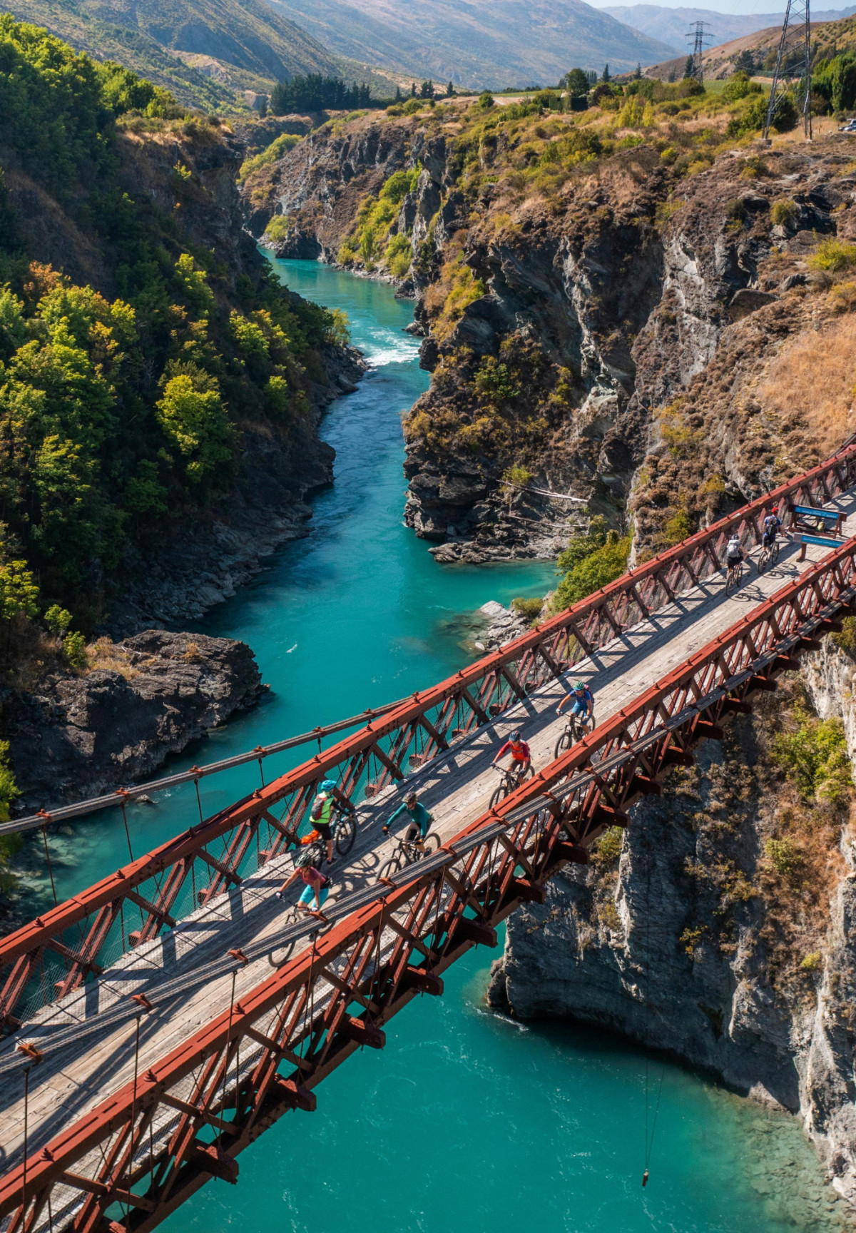
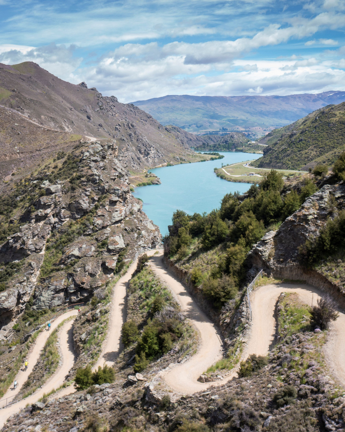
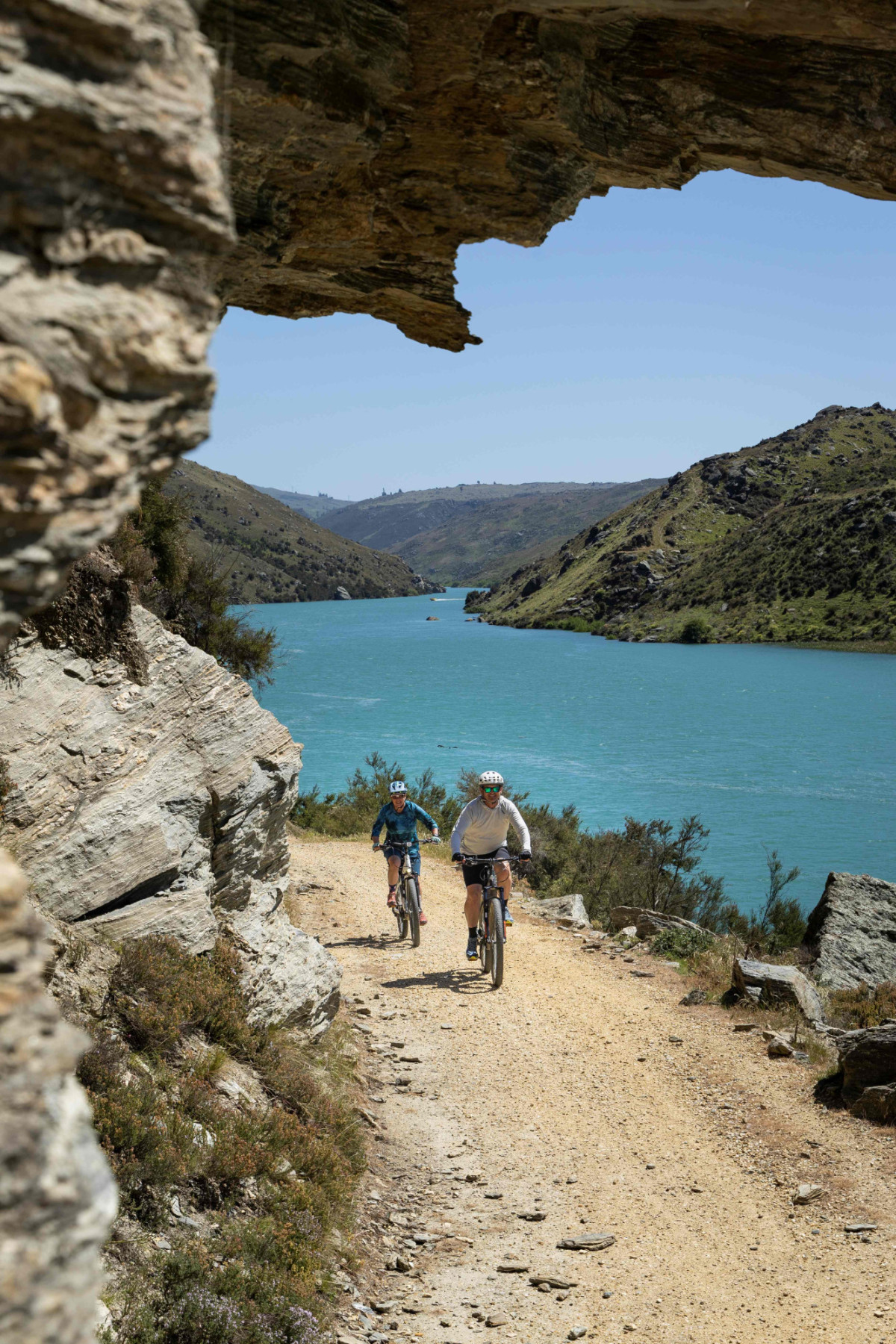
Stage 6: Clyde to Gibbston
62km via Lake Dunstan Trail and Kawarau Gorge Trail
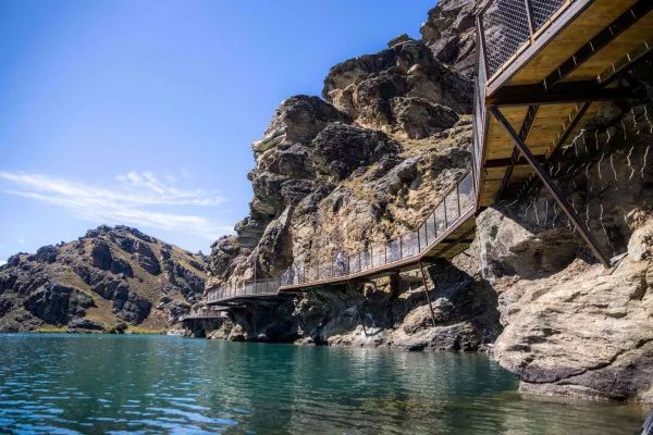
Distance 62km | Ascent 950m | Grade 2-3 | Duration 1-2 Days | Surface 98% Gravel : 2% Paved
*Note: the Kawarau Gorge Trail is currently under construction and due to open in September 2026.
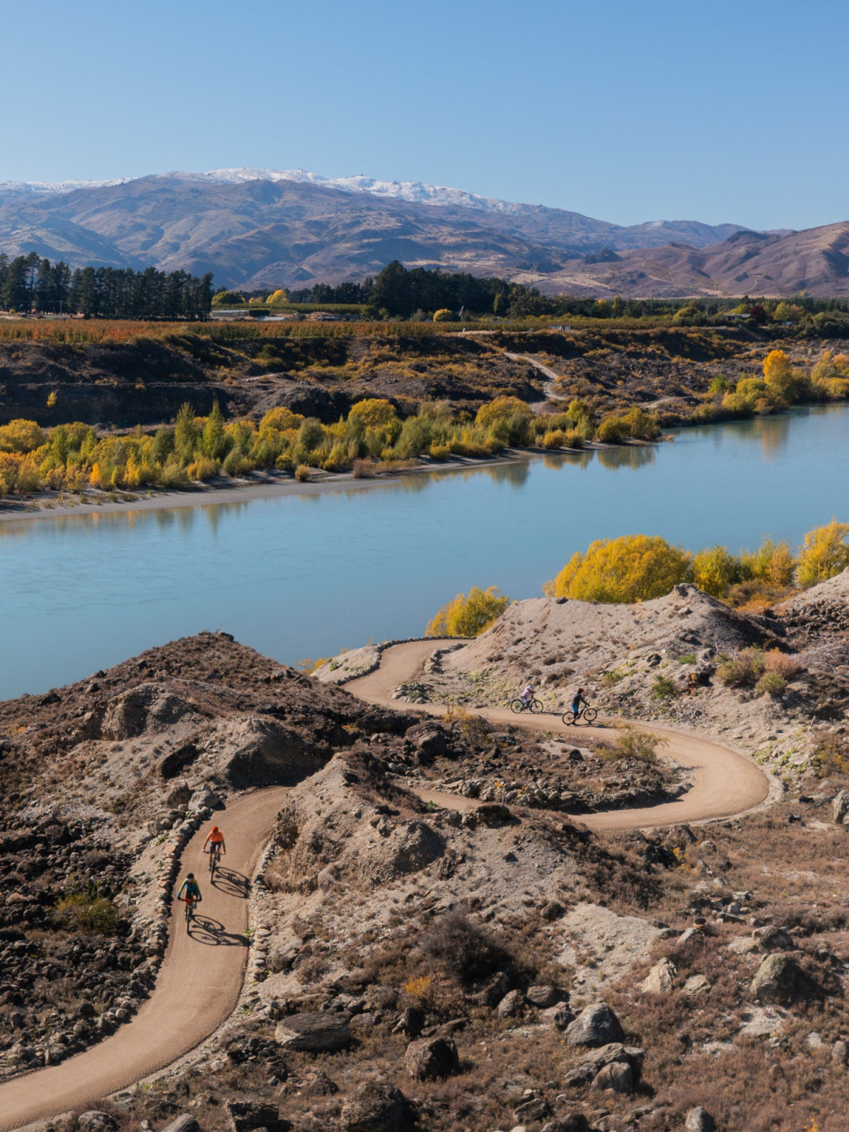
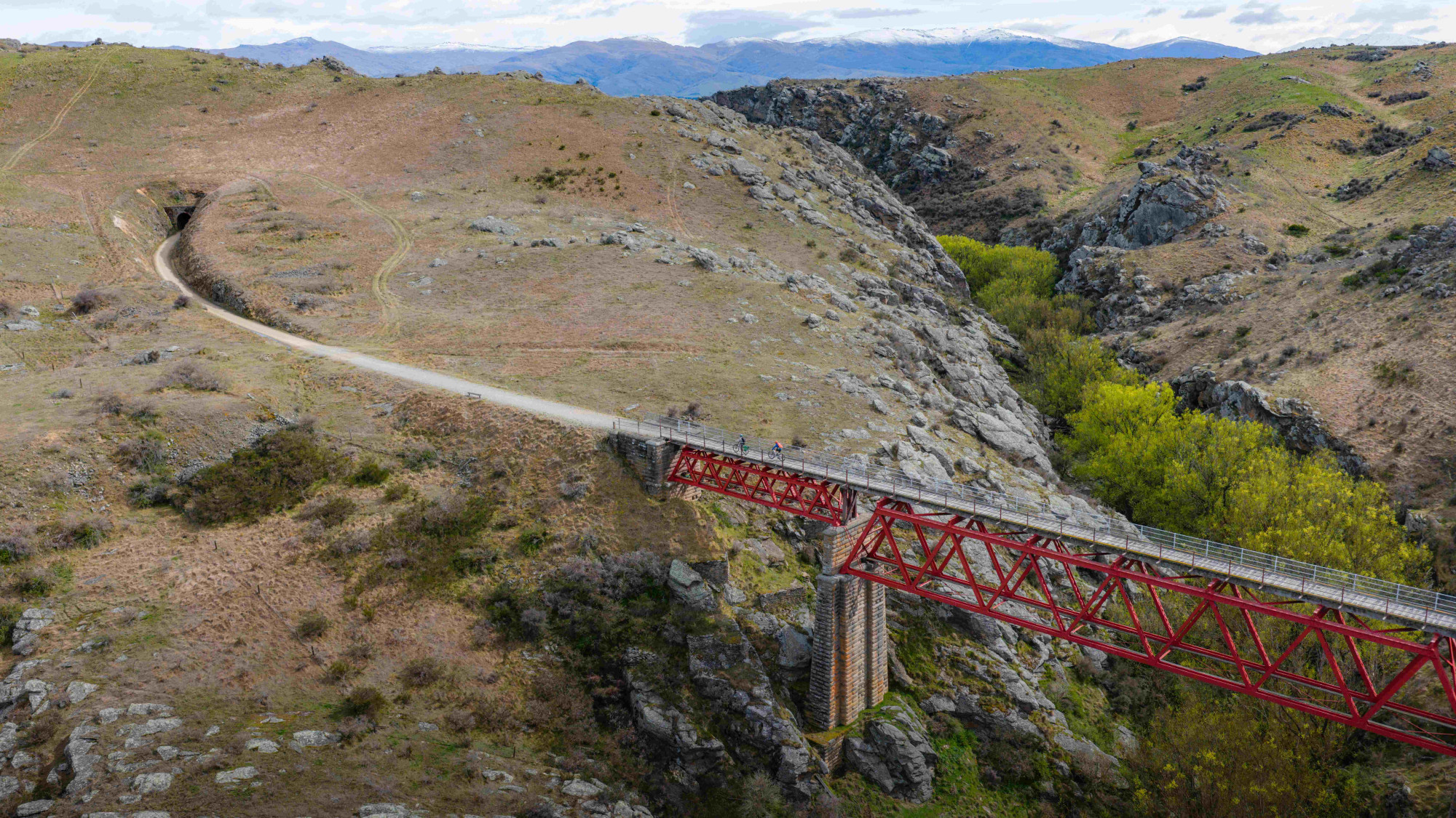
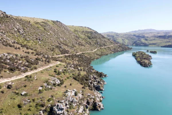
In Clyde, the Southern Way 1000 transitions from the Rail Trail – NZ’s original Great Ride – to the Lake Dunstan Trail and then the Kawarau Gorge Trail, the newest additions to the Great Ride network.
Departing Clyde, cross the Clutha River via the photogenic red bridge and head north towards the Clyde Dam to connect to the Lake Dunstan Trail. The next 35km section of trail to Bannockburn is an engineering marvel with a series of cantilevered ‘bluff bridges’ which cling to sheer rock walls, the impressive Hugo Bridge, and the spaghetti-like switchbacks of the Cairnmuir ladder… all set against the dramatic backdrop of the Cromwell Gorge.
The Lake Dunstan Trail can be busy, and with some narrow, exposed sections of trail care is required and you should be prepared to meet oncoming cyclists. Check out the useful video below to help prepare for the trail.
Allow 3-4 hours to truly appreciate the Lake Dunstan Trail, and to include some time for lunch at one of the many wineries in Bannockburn.
The spectacular new bike trail through the Kawarau Gorge connects Central Otago to Queenstown. The trail is the essential piece of connecting infrastructure needed to complete the Southern Way 1000 circuit and is due to open in September 2026.
In Bannockburn take the cycle trail along Felton Road – one of NZ’s most prestigious wine-growing regions – and connect to the 32km long, brand-new Kawarau Gorge Trail. Follow the trail upstream via another series of impressive bridges and cantilevered walkways, to connect to the Gibbston River Trail, part of the Queenstown Trails network. There are various accommodation and dining options available through Gibbston, with Kinross Winery a particular favourite, or you can push on to Arrowtown or Queenstown if time permits.
GPX coordinates and map
Stage 7: Gibbston to Queenstown
67km via the Queenstown Trails
Distance 67km | Ascent 785m | Grade 1-3 | Duration 1-Day | Surface 90% Gravel : 10% Paved
The final stage of the journey calls for a celebratory a lap of honour around the fabulous Queenstown Trails, with plenty of stops for coffee, cake and perhaps even a cold beer and pizza.
The Queenstown Trails network is comprised of over 150km of purpose-built cycling trails, and there are numerous different routes to connect to central Queenstown from Gibbston. Although this lap is only a day ride to complete the Southern Way 1000, you’ll inevitably want to spend longer in Queenstown to explore more of the trails like the epic Coronet Loop – a 50km single track backcountry adventure – or treat yourself to some lift-accessed downhill mountain biking at Skyline or Coronet Peak.
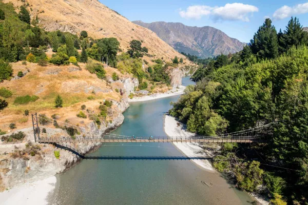
Departing from Gibbston, follow the Gibbston River Trail through vineyards and along the river to the Kawarau Suspension Bridge – the spiritual home of bungy jumping. Connect to the Arrow River Bridges Trail and ride on to historic Arrowtown, the perfect spot for a morning coffee or lunch. Having fully re-caffeinated in Arrowtown proceed through Millbrook Resort (a championship golf course) and hook on to the Wharehuanui Trail which traverses the lower slopes of Coronet Peak to Arthurs Point.
Arthurs Point is another good lunch option and maybe a cold beer at Gantley’s Tavern or Canyon Brewing, before descending the new Shotover Gorge Trail to the Hugo Tunnel, a lovingly restored remnant of the region’s goldmining days. Look out for jetboats below as you cross the Kimi-ākau suspension bridge and proceed along the Tucker Beach Trail to the Twin Rivers Trail which takes in views of both the Shotover and Kawarau Rivers.
At the Kawarau Falls Bridge join the Frankton Track which follows the shore of Lake Whakatipu and brings you back to central Queenstown, where your journey began some 1,000km ago.
Sprawl out on the beach at Marine Parade with an ice cream, or with a cold drink at one of the lakefront bars, and reflect on having just completing one of the world’s best, and newest, long-distance bikepacking routes.
Chapeau!
GPX coordinates and mapFrequently Asked Questions
Yes! It’s easy to create different itineraries especially by connecting the lower South Island’s network of Great Rides. These Great Rides are also well serviced by experienced bike tour operators which offer bike hire (including E-Bikes), accommodation and transport packages. A range of itineraries are available from 1-day rides to multi-day adventures. Check out Trail Hub for some itinerary options or visit the Great Ride websites below.
Queenstown Trails | Lake Dunstan Trail | Otago Central Rail Trail | Roxburgh Gorge Trail | Clutha Gold Trail | Around the Mountains Trail | Alps to Ocean Trail
No. Due to its length, the remoteness of some stages, and the variability of terrain, the Southern Way 1000 is best for experienced intermediate to advanced bike riders. However, Great Rides like the Otago Central Rail Trail, Clutha Gold Trail or sections of the Queenstown Trails are ideal for beginners to experience their first multi-day bikepacking adventure, with easy-to-book package options available across a variety of itineraries.
The difficulty is subjective depending on how long you take to ride the Southern Way 1000. Its the distance, elevation gain and remoteness of some stages that make the route challenging. Trying to cover the distance in 4 or 5 days is obviously going to be hard, but taking your time over a leisurely 2-weeks will be much easier.
The entire route is almost 1,000km long with over 10,000m of climbing, challenging Grade 4 sections, and it traverses some remote backcountry terrain only suitable for experienced, fit and well-prepared riders.
The surface of the route is generally in good condition and a mix of purpose-built cycle trails, or well-maintained gravel roads. The hardest section is Stage 2 across the Nevis Road where the weather and remoteness can make conditions difficult. Stage 4 from Dunedin to Middlemarch includes a hilly ride across Ramrock Road, but this can be avoided by catching a train from Dunedin to Pukurangi (a 20km ride from Middlemarch and the start of the Otago Central Rail Trail).
The other stages are predominantly on Great Rides, which are well maintained trails with excellent infrastructure for cyclists, with regularly spaced trail towns offering accommodation, cafes and stores for supplies, as well as transport options.
The Southern Way 1000 is a loop, so if you're undertakig the whole ride, no need to worry about one-way logistics!
But if you're only riding a section of the route then the supporting infrastructure for the Great Ride cycle trails is excellent. Getting to the start, returning from the finish, and transporting bikes is easy with numerous bike tour operators offering shuttle services across the region. The Southern Way 1000 is also connected by international airports in Queenstown and Dunedin, and a domestic airport in Invercargill.
Yes, bike hire, including E-Bikes is widely available. Bikes are generally mountain bike style (hard tail or full suspension) and some operators have started supplying gravel bikes for longer bikepacking itineraries. Bike hire usually includes helmet, basic toolkit and panniers. Key hubs for multi-day bike hire are in Queenstown, Arrowtown, Cromwell, Clyde, Alexandra and Dunedin.
The Southern Way 1000 route is suitable for gravel bikes, hardtail mountain bikes and some E-Bikes. The trail surface for most of the route is either on smooth gravel cycle trails or generally well-maintained gravel roads with some short, paved sections.
With a couple of long, hilly stages E-Bikers should ensure that they have sufficient range in their batteries, especially where the route passes through backcountry areas where there will be no battery charging options. E-Bikers will also need to consider river crossings on the Nevis Road as carrying a heavy E-Bike through knee to waist deep water is challenging.
For those undertaking a shorter itinerary utilising the Great Rides network only, then E-Bikes are ideal with charging available at most accommodation providers.
The Ngā Haerenga Great Rides of New Zealand website has an excellent what to pack guide here.
Camping equipment (tent, sleeping bag, cooking gear etc.) is not required on the Southern Way 1000 as the stages are all serviced by towns regularly spaced along the route and which offer a variety of accommodation. However, should you wish to carry a tent, then campgrounds are widely available, but please camp responsibly and follow the rules. More information on camping here.
Queenstown and Dunedin are key hubs along the route, and both have airports serviced by regular domestic and trans-Tasman flights. Invercargill domestic airport is also an option that’s widely used by riders undertaking the Tour Aotearoa (length of NZ ride). Connect to the Around the Mountains Trail from Invercargill via the Southland Traverse Heartland Ride.
Yes. The Southern Way 1000 connects 7 of the South Island’s Great Rides across Southland and Otago.
You can also connect to the Alps to Ocean Trail from the Otago Central Rail Trail via Danseys Pass (north west of Ranfurly and Naseby).
There are numerous other great bikepacking and gravel riding routes across the lower South Island, check out Trail Hub for more ideas or refer to the New Zealand Cycling Map
The Southern Way 1000 is best ridden between late October – early May (spring – autumn), with late summer and early autumn generally offering the most stable weather patterns. But the weather can change quickly – especially in high-country environments – so you’ll need to be prepared with warm and wet weather gear and sun protection at any time of year.
The climate can vary greatly across the Southern Way 1000, with the Around the Mountains Trail passing close to Fiordland, NZ’s wettest region, whereas neighbouring Central Otago is often the hottest and driest part of the country in summer and can be the coldest in winter.
The Great Rides themselves can be ridden year-round. Check out these tips for winter riding and summer riding.
*NOTE: The Nevis Road is closed in winter from June – September, and Ramrock Road between the east coast and Middlemarch can be subject to snow and closures in winter.
Yes, it is a good idea to book ahead, especially during school holidays and the peak summer to autumn period (January – April).
Accommodation is available to suit most budgets and styles ranging from campgrounds and cabins, to motels, B&Bs, country hotels (pubs) and upmarket lodges. Click the links below to find regional accommodation options:
Queenstown | Central Otago | Dunedin | Clutha | Around the Mountains Trail (Southland)
Yes. Daily luggage and gear transfers are available from bike tour operators across Otago and Southland’s network of Great Rides meaning you can travel fast and light with your bags transported to your accommodation each night.
The backcountry section across the Nevis Road (stage 2) is not supported with luggage transfers, and special arrangements may be needed between Waihola - Dunedin and Dunedin - Middlemarch as services are less frequent and run “on demand” by operators on these sections.
Fully self-supported bikepacking (carrying tent, sleeping bag etc) is a viable option, but with accommodation widely available, traveling light without camping gear is entirely possible.
The trails of the Great Rides are all well signposted making navigation easy, but downloading the Great Rides App is useful and includes commentary on points of interest.
Navigating through Dunedin, Queenstown and other towns is easily achieved using Google Maps or similar on a smartphone. The small rural settlements are generally simple to navigate.
The GPX and route information is available on Ride with GPS here.
Downloading the South Island NZ Topo50 App for your smartphone is also a good investment to help with offline navigation in remote areas and has good GPS functionality.
The Sothern Way 1000 includes remote, wilderness sections with limited or no phone coverage, steep descents on gravel roads which can be lose and rutted, numerous river crossings, and sometimes rapidly changing weather – especially in the mountains. Riders need to prepare and plan appropriately and be self-sufficient for these remote sections carrying warm and wet weather clothes, toolkit and spares, sufficient food and water, first aid kit and an emergency communication device like a PLB or satellite messenger.
It is a legal requirement in NZ for cyclists to wear a helmet.
Cyclists should follow the NZ Road Code on public roads. Whilst most of the public roads included in the route are quiet rural roads, expect to encounter traffic at any time and keep left. Extreme care should be taken on the short SH1 sections north of Dunedin.
The cycle trails are all 2-way, multi-use walking and cycling trails and it’s important to understand trail etiquette and be courteous to fellow trail users.
Patchy, but improving. On remote sections of the route like the Nevis Road or the Lake Dunstan Trail cell phone reception can be intermittent, but there is generally good coverage at the towns and villages across the lower South Island.
It is highly recommended that you carry a personal locator beacon (PLB) or a satellite messenger device (such as a Garmin InReach) for the backcountry sections. Always let someone know your intentions.
Yes. With most of the route following the network of Great Rides, trail towns and resupply points are generally no more than 25-40km apart. Most small towns you ride through will have a pub, café or bakery and most (but not all) will have a convenience store for basic supplies as well as accommodation options.
There is a long gap between services on the Around the Mountain Trail between Walter Peak and Mossburn, on the Nevis Road between Garston and Bannockburn and then on Ramrock Road between Waikouaiti and Middlemarch. Carry extra food and water for these sections.
Treat any water collected from streams or creeks before drinking.
If you’re planning a trip during winter, it pays to check the opening times of rural pubs and cafes, as some operate a reduced service in winter months.
To fly with a bike in NZ, you must pack it in a proper bicycle bag or box. Your bike counts as one item of your checked baggage allowance, and you may need to pay an oversized item handling fee depending on your airline. Queenstown Airport has an excellent guide to flying with a bike here.
Here are some airline requirements to keep in mind, but check specific details with your airline in advance of departure:
- Air New Zealand: Deflating tyres is not strictly required, but handlebars must be turned sideways, pedals removed or turned in, and struts (shocks) must not exceed 29 PSI.
- Jetstar: Requires you to deflate tyres, detach pedals, and fix the handlebars parallel to the frame.
- E-Bikes: Battery-powered devices, lithium batteries, and spare gas cartridges have strict restrictions or are generally prohibited as checked baggage. Generally, airlines do not permit you to fly with E-Bike batteries. Check with your airline for details.
If you don't own a bike bag, check with your local bike shop as they often have old bike boxes available. Air New Zealand sells cardboard bike boxes at the airport, but these are subject to availability.
The Southern Way 1000 - A New Short Film
TERRA: Bound
TERRA: Bound is a short, spoken-word film that follows two cyclists as they embark on the first known ride of the Southern Way 1000.
This inspirational film frames cyclists as small figures set against the vast, shifting landscape of New Zealand’s lower South Island, and captures the essence of what bikepacking feels like from the saddle.
TERRA: Bound will make its world premiere at the New Zealand Mountain Film Festival on 20th June 2026 and will then be screened across Australia as part of the Big Bike Film Night tour from July – September 2026.
Additional screenings at international film festivals are to be announced soon. Watch this space!
Visitors Book
The Southern Way 1000 Visitors Book is a simple, honesty-based way for riders to record and commemorate when they've completed the route, share a few reflections, and add a photo. It’s not intended as a formal results or verification platform, so no GPS files or proof of completion are required.
While some riders may choose to record personal bests or chase fastest known times (FKTs), the route is designed as a bikepacking journey which is best enjoyed slowly, safely and respectfully, with consideration for the conditions and other trail users.
Visitors Book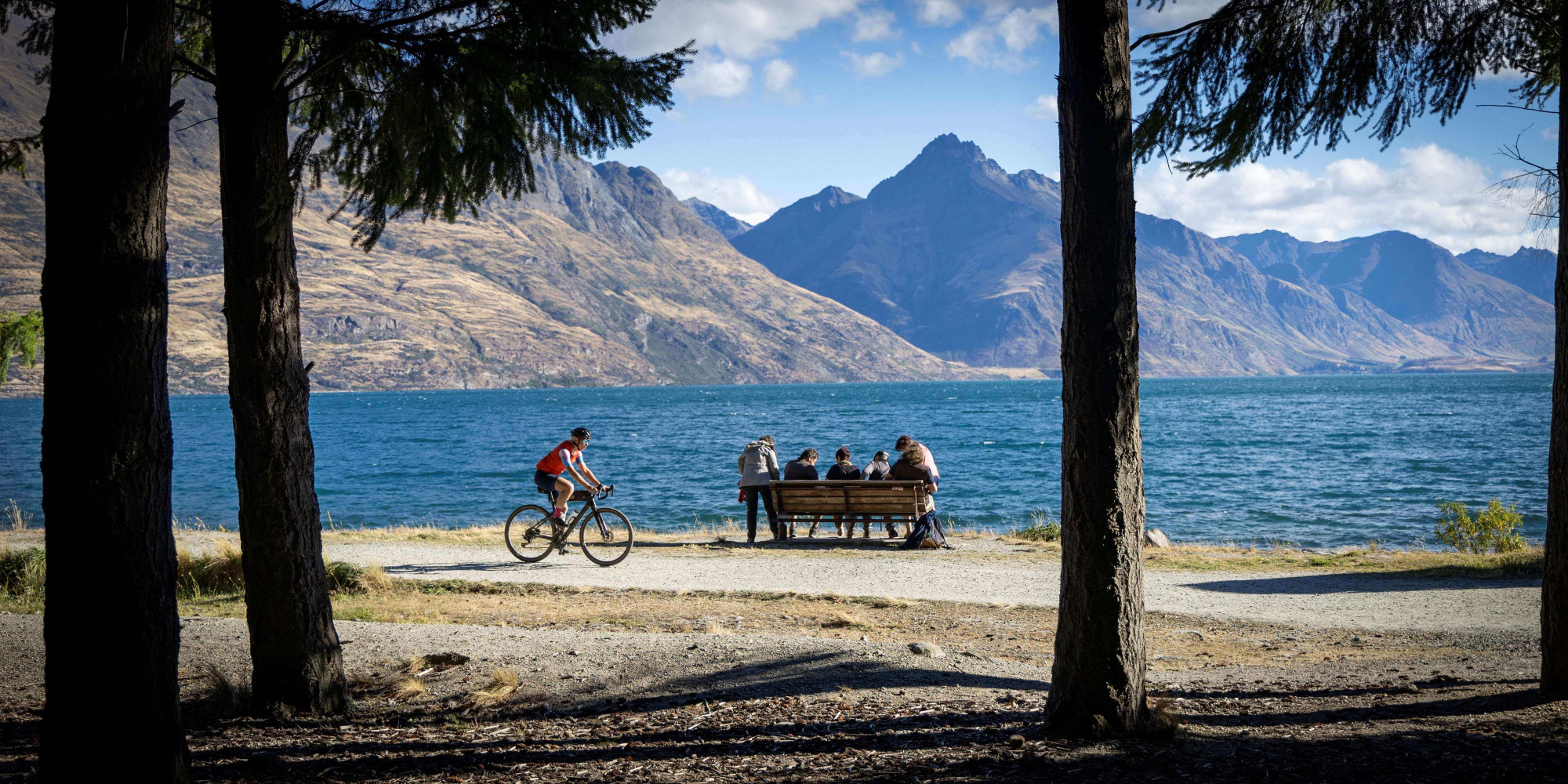
Great Rides of the Lower South Island
Explore eight Ngā Haerenga Great Rides of New Zealand across the lower South Island. Spanning more than 1,000km, these purpose-built walking and cycling trails showcase stunning landscapes, rich heritage, historic towns, vineyards, and local hospitality. Ride them as individual multi-day adventures or connect them into one unforgettable South Island loop.